
The Medieval World
Editorial National Geographic Society
Fecha de edición octubre 2010
Idioma inglés
EAN 9781426205330
384 páginas
Libro
encuadernado en tapa dura
Resumen del libro
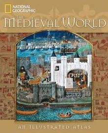
and across Europe and the Middle East, charting the lands and events of the period known as the Middle Ages. Artworks, maps, and fine photography illuminate the key events of every century, beginning with the fall of the Roman Empire in A.D. 476 and moving forward to A.D. 1500 - the beginning of the age of discovery. Vibrant text from author John M. Thompson captures the drama and intrigue of the era, exploring wars, migrations, occupations, and inventions. Three hundred illustrations - antique paintings, magnificent portraits, illuminated manuscripts, and historical documents such as "Magna Carta" and the "Domesday Book" - lend rich immediacy. More than 60 maps, among them specially commissioned illustrated presentations and a lavishly drawn crusader map from A.D. 1170, chart important routes and events including the spread of Christianity and Islam. Twelve richly illustrated spreads chronicle the amusements, clothing, feasts, science, books, animals, and other aspects of daily life in the Middle Ages. Voices of the medieval world come alive through quotations from literature, letters, and journals that have survived the passage of time.
Biografía del autor
NEIL KAGAN es editor y dirige la empresa Kagan x{0026}lt;( x{0026}amp;x{0026}lt;) Associates, especializada en el diseño y la elaboración de libros ilustrados. Ha creado numerosas colecciones centradas en la historia estadounidense de reconocida fama.