Libros
La librería
Agenda
0
Cesta (0)
Libros
La librería
Agenda
Zona de usuario
Título
Autor
Idioma
----------
Español
English
Deutsch
Français
Italiano
Português
Lenguas europeas
Lenguas del mundo
Más que libros
Editorial
Desde
--------
2026
2025
2024
2023
2022
2021
2020
2019
2018
2017
2016
2015
2014
2013
2012
2011
2010
2009
2008
2007
2006
2005
2004
2003
2002
2001
2000
1999
1998
1997
1996
1995
1994
1993
1992
1991
1990
1989
1988
1987
1986
1985
1984
1983
1982
1981
1980
1979
1978
1977
1976
1975
1974
1973
Hasta
--------
2026
2025
2024
2023
2022
2021
2020
2019
2018
2017
2016
2015
2014
2013
2012
2011
2010
2009
2008
2007
2006
2005
2004
2003
2002
2001
2000
1999
1998
1997
1996
1995
1994
1993
1992
1991
1990
1989
1988
1987
1986
1985
1984
1983
1982
1981
1980
1979
1978
1977
1976
1975
1974
1973
Palabras clave
Restaurar filtros
Buscar
Cerrar
Su carro de la compra está vacío
Volver
Collins Maps
Compartir
Bibliografía de Collins Maps
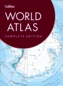
Collins World Atlas : Complete Edition
48,65 €
Collins Maps
1
1
Mantente al día de la
actualidad de Pasajes
He leído y acepto
la política de privacidad.
Suscribirme